Skip the crowded trailheads and head to these secretive routes instead
The lottery gets Half Dome, the crowds get the Mist Trail, and Instagram gets… well, pretty much everything. But if you’re the type of hiker who’d rather share a trail with a mule deer than a hundred strangers on some of the Valley’s most popular day hikes, Yosemite (and the wilderness surrounding it) still has plenty of secrets left to give up.
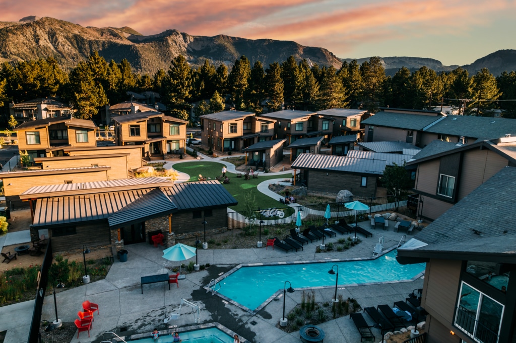
Staying at Outbound Yosemite puts you in the sweet spot for exactly this kind of exploring. You’re close enough to the park’s South Gate to be on the trail before the shuttle lines form. But you’re also perfectly positioned to head the other direction, into the pine-covered hills around Bass Lake and the Sierra National Forest, where the trailheads are just as beautiful and about a hundred times quieter. Spend your days chasing waterfalls, meadows, and sequoias most visitors never find, then come back to soak tired legs in the pool or hot tub before a well-earned pizza and libation at Juniper Crafted Pizza + Bar. Plus, if you forgot any gear at home, you can rent essentials from Outbound’s Gear Garage; the Hyperice recovery kits are especially nice after a long trail day.
Here are five of our favorite under-the-radar hikes to get you started.
Wawona Meadow Loop
Distance: 3.5 to 5.0 miles (there are two loop options)
Elevation Gain: ~250 ft
Trail Type: Loop
Difficulty: Easy (with the longer loop only slightly more difficult)
Trailhead: Across Wawona Road from the Wawona Hotel (a few dirt pull-offs are also available near the trail’s eastern crossing)
Best Time: Spring for wildflowers; fall for leaf-peeping
If Yosemite Valley’s greatest hits leave your legs (or your patience for parking) feeling wrecked, the Wawona Meadow Loop is the antidote. This flat, sun-dappled path follows an old road around the edge of a broad meadow in the park’s quieter southern reaches, and it’s one of the few trails in Yosemite where dogs and bikes are welcome, too. The longer loop option has a bit more elevation gain, but it’s still pretty mellow. Expect birdsong, seasonal wildflowers, the occasional deer grazing at the meadow’s edge, and views across the grass toward Wawona Dome (think Half Dome’s little sister).
It’s an easy morning warm-up or evening cooldown option. And, since it sits right in Wawona’s tiny commercial hub, it’s the rare trailhead where you can grab a coffee and something to eat at the historic Wawona General Store (and post office) beforehand and still make it back to your car without breaking a sweat.
Tuolumne Meadows to Glen Aulin
Distance: ~11.5 miles round trip
Elevation Gain: ~1,150 ft
Trail Type: Out-and-back
Difficulty: Moderate
Trailhead: Lembert Dome / Soda Springs area, Tuolumne Meadows (Tioga Road)
Best Time: Mid-summer through early fall, once Tioga Road is open
While everyone else is crowding onto the Mist Trail, the high country along Tioga Road stays comparatively empty, and Glen Aulin is one of its best-kept secrets. This trail eases downhill out of Tuolumne Meadows alongside the Tuolumne River, past wildflower-stuffed meadows that eventually give way to a string of cascades and waterfalls tumbling toward the Glen Aulin High Sierra Camp.
Bring a swimsuit for the granite pools along the way (but brace yourself for the cold water), and budget extra time to just sit and watch the river do its thing. Because the return trip is a steady climb back up, this one is best tackled in the cool of morning. Water is plentiful along the route, but it’s backcountry water, so filter before you drink. A permit is only required if you’re going to overnight out there.

Snow Creek Trail
Distance: ~9.4 miles round trip
Elevation Gain: ~2,700 ft
Trail Type: Out-and-back
Difficulty: Strenuous
Trailhead: Mirror Lake Trailhead (shuttle stop #17)
Best Time: Spring and fall, early morning starts recommended
This is the trail Yosemite hands you when you say you want a “hidden gem” and mean it. Starting from the relatively mellow Mirror Lake Trail, Snow Creek peels off and starts switchbacking—more than a hundred of them—straight up the wall of Tenaya Canyon to the valley rim. It’s a legitimate leg-burner with very little shade, so an early start and plenty of water are non-negotiable. The reward: a dead-on view across the canyon to Half Dome and Clouds Rest that most Valley visitors never see, since so few are willing to earn it. Once the switchbacks ease off near the top, a short stretch of forest leads to a footbridge over Snow Creek itself, which is a perfect spot to dunk your feet and filter and refill your water bottles before heading back down.
Note: It’s worth checking with the National Park Rangers to make sure Snow Creek is running, especially late in the summer during drought years. The hike is still worth it; you just might not be able to plan on filtering water at the mid-point, which would mean you’d need to bring double. Hydration is important!
Corlieu Falls & Red Rock Falls via Lewis Creek Trail
Distance: ~3.9 miles round trip
Elevation Gain: ~500 ft
Trail Type: Out-and-back
Difficulty: Moderate
Trailhead: Highway 41, Sierra National Forest (between Oakhurst and Yosemite’s South Gate)
Best Time: Spring, when snowmelt keeps the falls running strong
You don’t even have to enter the park to find a great waterfall hike in the Yosemite area (which can be a real blessing during the busy season). This one is just off Highway 41 in the Sierra National Forest, not far from Bass Lake and an easy detour on the drive up from Outbound Yosemite.
The Lewis Creek Trail winds through mixed conifer forest along its namesake creek, passing the cascading Corlieu Falls before continuing on to the taller, more dramatic Red Rock Falls. It’s a moderate workout with a couple of rocky, scrambly sections, so sturdy shoes are a good idea. But it’s shaded most of the way and makes a great midday option when the Valley floor is baking. Go early in the season for the biggest water; by late summer the falls can slow to a trickle.
Chimney Tree & Bull Buck Loop, Nelder Grove
Distance: ~1.7 miles
Elevation Gain: ~240 ft
Trail Type: Loop
Difficulty: Easy
Trailhead: Nelder Grove Campground, Sierra National Forest (off Sky Ranch Road, south of Yosemite’s South Gate)
Best Time: Spring through fall (the access road can be rough or snowed in during winter)
Mariposa Grove gets all the attention, but Nelder Grove, which is tucked into the Sierra National Forest just a few miles from the park’s south entrance, is where you go for giant sequoias without the tour-bus crowds.
This easy loop threads through a mix of towering, centuries-old sequoias and stumps left behind from the area’s logging days, with interpretive signs explaining the history. The highlight is the Bull Buck Tree, whose base flares out so dramatically it rivals the girth of some of the biggest sequoias on Earth. Access requires a bit of a drive on a winding forest road, so a vehicle with decent clearance helps. But the payoff is quiet, shaded, and genuinely awe-inspiring.
A Few Reminders
Wherever you’re headed, bring more water than you think you’ll need, and check current trail and road conditions before you go. This is especially true for anything along Tioga Road or the forest roads outside the park, both of which can be seasonal. A paper map or downloaded route is a smart backup once you lose cell service, which is most of the time out here. Always bring extra calories and a warm layer, too, just in case. Also, plan at least a three-day getaway; you want plenty of time to do at least a few hikes.

However far off the beaten path your day takes you, know that a soft bed, a warm meal, and Outbound Yosemite’s pool and hot tub are waiting for you at the end of it. You’ll have earned it.